One week course for the University of Yaoundé – Course Plan
One week course for the University of Yaoundé
“Multidimensional Visualization and its Applications“
Professor Alfred Inselberg assisted by
Mr. GEBREMEDHIN Fisseha Gidey
Mandatory textbook “Parallel Coordinates: Visual Multidimensional Geometry and Its Applications”, Springer 2009
Daily 3 hour sessions with interactive demonstrations. There will 50 minute lectures with in between breaks. Some lectures require Internet access. Homework from the textbook will be assigned and presented in writing at the next lecture. Additional one-hour sessions for discussions with participants.
Syllabus
- Introduction to Scientific, Information and Multidimensional Visualization
- Projective Geometry – Foundations, Duality, Homogeneous Coordinates
- Parallel Coordinates in the Plane – Dualities, Transformations, Visual and Automatic Data Mining
- Lines in N-space – Representations of Lines, Distance & Proximity Properties
Applications : Collision Avoidance Algorithms for Air Traffic Control.
- Coplanarity – 2 Representations of Planes, Flats & Hyperplanes
– Recursive Mapping, dualities and demos, “Near Coplanarity” – a central problem in many applications, Data Mining
- Curves – Including theory of Envelopes
- Proximities (Topologies) – Lines, Planes and Hyperplanes, Approximations
- Hypersurfaces in N-space – Representation in terms of (N −1) planar regions. Classes of surfaces: Developable, Ruled, Algebraic, Convex, some Non-Convex
and Non-orientable. Detecting convexity and non-convexities. Interior Point Algorithms, More on Data Mining, Decision Support & Process Control, (Trade-Off Analysis, Sensitivities and Interrelations, Impact of Constraints, a little on Optimization), Research Topics
Multidimensional Visualization and its Applications
Prof. Alfred Inselberg
aiisreal@post.tau.ac.il, www.cs.tau.ac.il/~aiisreal/
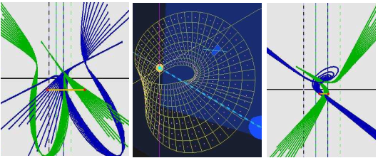
Visualization systematically incorporates our fantastic pattern recognition ability into the problem-solving process. With parallel coordinates the perceptual barrier imposed by our 3-dimensional habitation is breached enabling the visualization of multidimensional problems. Beginning with some projective geometry the mathematical foundations are developed. Multidimensional lines and (hyper)planes are recognized even in the presence of errors. Applications include Collision Avoidance Algorithms for Air Traffic Control, Data Mining for High-Dimensional datasets (some with hundreds of variables), Automatic Classification (feature extraction), and more. Properties of (hyper)surfaces are visually detected from their representation, convexity is seen in any dimension as well as non-convexities (i.e. folds, bumps, depressions etc) also non-orientability (i.e. Moebius Strip). The topics are illustrated with many interactive demonstrations and further applications on Decision Support (Trade-off Analysis), Topics in Statistics, Process Control, Analysis of Large Networks, Visualizing Complex Valued Functions. The course is suitable for good 2nd & 3rd year as well as M.Sc. and Ph.D. students. Linear Algebra and a course on Algorithms with Data Structures are prerequisites — or consent of the instructor.
IMPORTANT. A complete overview of the course with demos will be given in the first lecture.
Beautiful website Milestones in Thematic Cartography by M. Friendly et al:
www.math.yorku.ca/scs/SCS/Gallery/milestones – take a look.
Les étudiants désireux de prendre part doivent s’enregistrer grace à ce formulaire : https://docs.google.com/forms
Document to Download: